California Just Fast-Tracked Over 300 Wildfire Projects in a Year. Here's What That Means for You
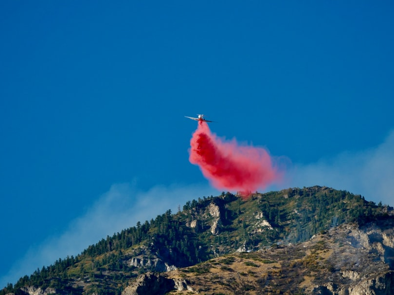
Photo by Margaret Giatras on Unsplash
California is moving at lightning speed to fight back against catastrophic wildfires, and the results are actually pretty impressive. One year after Governor Newsom declared a state of emergency to cut through red tape, the state has approved over 300 wildfire safety projects across nearly 57,000 acres. What used to take years to get approved now happens in as little as 30 days.
This streamlined process is a big deal because it removes bureaucratic barriers that normally slow down forest management work. State agencies, tribes, resource conservation districts, and private landowners have all benefited from the faster permitting system. The projects span across the entire state and are tackling wildfire risk from multiple angles, creating defensible spaces around communities, improving evacuation routes, reducing dangerous fuel buildup, and restoring ecosystems.
Some standout projects show what’s actually getting done on the ground. In Los Angeles, a 600-acre fuels reduction project is protecting communities near the Palisades area. Up in Humboldt County, the 450-acre Prosper Ridge Community Wildfire Resilience Project is incorporating cultural burning and prescribed fire to protect residents. And in Siskiyou County, a nearly 3,000-acre project is restoring ecosystem health while safeguarding vulnerable rural communities.
Beyond just speeding up approvals, California is beefing up its entire wildfire response operation. The state has nearly doubled CAL FIRE’s budget from $2 billion to $3.8 billion since 2019, which has allowed them to grow their workforce from about 5,800 to over 10,700 positions. CAL FIRE is also hiring thousands more firefighters over the next several years to meet growing demand.
The state is also investing heavily in cutting-edge technology. California now has the world’s largest aerial firefighting fleet, including three C-130 Hercules airtankers that can drop massive amounts of fire retardant in a single mission. The state also just released statewide LiDAR maps, basically high-tech scanning data that shows exactly where wildfire fuel has accumulated across California. For the first time, agencies and communities have a complete, detailed picture of forest and vegetation conditions across the entire state.
Governor Newsom has invested over $5 billion in wildfire and forest resilience since 2019, with an additional $135 million available for new and ongoing prevention projects. The state also deployed $170 million from voter-approved Climate Bond funding specifically for wildfire resilience projects, with over $48 million already awarded. In Southern California alone, $38 million is going directly to reduce wildfire risk, including $20 million for projects protecting communities impacted by the Palisades Fire.
Applications for the streamlined project approval process are being accepted through May 1, 2026. If you live in a wildfire-prone area, now’s the time to make an evacuation plan, pack a go bag, and sign up for local emergency alerts. You can learn more about wildfire preparedness at ReadyforWildfire.org.
AUTHOR: cgp
SOURCE: gov.ca.gov


![Maritime Safety and Security Team trains in Los Angeles [Image 2 of 3]](https://firebasestorage.googleapis.com/v0/b/sf-frontier.firebasestorage.app/o/JVfwZvDwGEJnTQ17sefi-md.webp?alt=media)